|
Archaeological Exploration in Brampton Abbotts Village
Archaeological Study of Brampton Abbotts
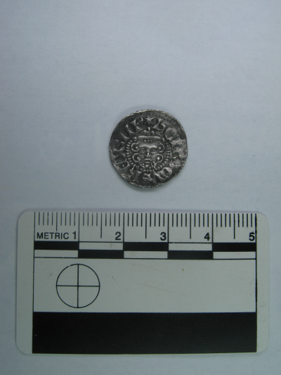
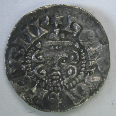
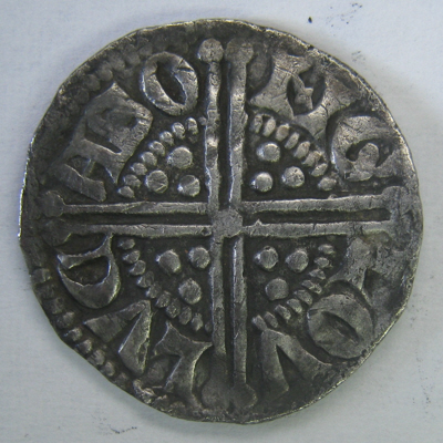
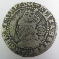
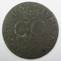
February 24th 2013. This silver Henry III penny, made by the Lucas of Gloucester mint around 1248 - 1250, was found by Dr Patrick Brown in Brampton Abbotts today.
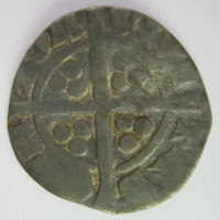
This tiny Charles I penny has a die error:
It should read C.D.G. ROSA SINE SPINA IUS THRONUM FIRMAT on the reverse but it has a spelling error TRHONVM rather than THRONVM.
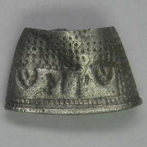
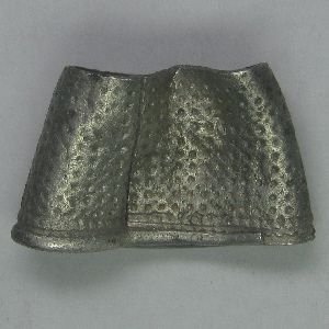
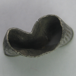
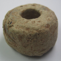
This thimble which has the owner's initials, MP. Once it is accurately dated (my guess is 1650 to 1725) it may be possible to trace the owner, because they were probably related to the landowner:
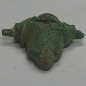
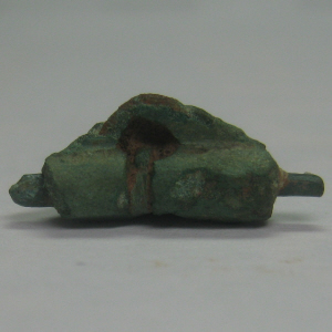
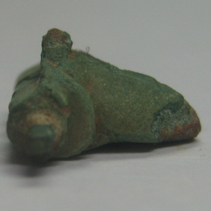
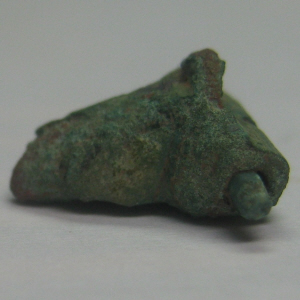
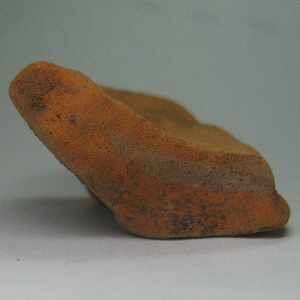
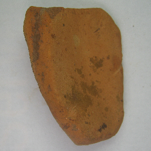
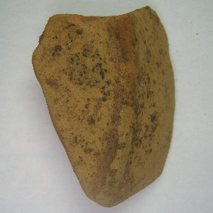
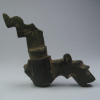
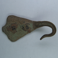
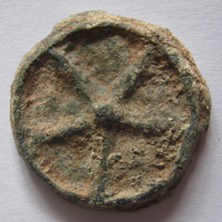
Dr Brown said he had got just over an hour between rolling and potato planting, and this stump of a roman brooch turned up:
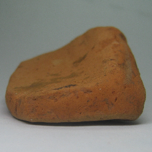
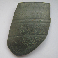
along with some Roman pottery fragments, two of which are:
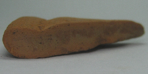 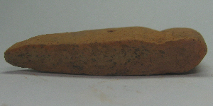
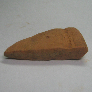 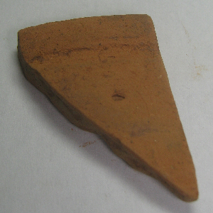
and:
October 2012
The Archaeology study of Brampton Abbotts is now making progress.
In September 2012 , having obtained permission from the landowners, Herefordshire’s archaeologist Neil Rimmington and members of the group inspected known sites of interest..JPG)
The sites of the known crop circles near Monk’s wood are not really visible. It had been hoped that inspections of the boundary hedge would preserve some clue of the form of the features, but nothing could be seen –although the area concerned does appear to be flatter.
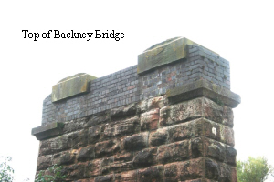
We then walked on down to inspect the Withy Pools. This area was recorded on the tithe map as withy beds, but the earthworks seen are recent creations. Next we looked at the remains of the Backney railway bridge and walked alongside the course of the railway before heading back towards the village.
The field alongside the Village Hall – now known as Grove Meadow is recorded to have been the site of buildings in the 19th century, although this can now only be identified by the flatter areas. The orchard opposite also shows obvious signs of earthworks and Neil believes that the current pond must have been continued down to the hedge area where there is a large earthwork dam. There are two possible reasons for such a large pond – either it is a mill pond or a fish pond. The lack of both room and height change next to the lane would suggest it could not be a mill and therefore it is probably a fish pond. Other earthworks within the orchard suggest former buildings or garden enclosures.
 One other field of interest is that at the rear of Oak House Nursery school. This has at its west end a number of earthworks and those nearest the road are quite level suggesting probable building sites with the garden enclosures extending south. One other field of interest is that at the rear of Oak House Nursery school. This has at its west end a number of earthworks and those nearest the road are quite level suggesting probable building sites with the garden enclosures extending south.
It is a reasonable conclusion that these earthworks represent earlier phases of the settlement in the medieval period. These remains are important in the understanding of the development of the village, as most standing buildings pre-dating the 19th century have gone and later 19th century and 20th century taken its place.
.JPG) Using the 1838 Tithe map produced by Geoff Gwatkin, members of the group had identified several properties that were shown that still exist. Copies of this very interesting map can be purchased from Geoff who lives in Ross-on-Wye. For more details see his website Using the 1838 Tithe map produced by Geoff Gwatkin, members of the group had identified several properties that were shown that still exist. Copies of this very interesting map can be purchased from Geoff who lives in Ross-on-Wye. For more details see his website
www.geoffgwatkinmaps.co.uk
Three of the current properties were inspected – much to the interest of the current occupants. One owner has a large number of interesting old documents and deeds.
 It is hoped that some of the owners of other older properties will allow visits to photograph any features of particular interest. It is hoped that some of the owners of other older properties will allow visits to photograph any features of particular interest.
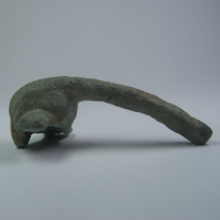
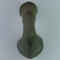
We have recently been contacted by an enthusiastic metal detector who (with permission from the landowner) has made an intensive study of one area of the village. He has made a number of interesting finds including metal objects and pottery some of which is known to be Roman or Medieval. He has very kindly given his permission to reproduce some of his photos and also provided a link to the British Museum where many finds are recorded – here is the link:-
http://finds.org.uk
http://finds.org.uk/contacts/staff/profile/id/56
We have also been given contact details for the person responsible for recording all finds in Herefordshire and Shropshire and in due course we will add a link so that any future finds can be reported to the right person.
NB. if this inspires you to go out looking for yourself, it must be stressed that it is important that you obtain the permission of the landowner and of course no damage must be caused.
Dr Patrick Brown who has made many objects in the area has kindly researched a link to the British Museum to show all finds in the Brampton Abbotts area:-
http://finds.org.uk/database/search/results/lat/51.9082762032/lon/-2.58203202909/d/3/postcode/HR9+7JD
Summer 2012
Archaeological records of areas have often developed in a piecemeal fashion and therefore the records can become biased to particular areas or features. With the support of funding from the Wye Valley AONB, Herefordshire Council’s Archaeology Service in partnership with the local community has the opportunity to improve the record for Brampton Abbotts parish. The aim is to use local knowledge in combination with historical maps and documents, aerial photographs and fieldwork to ensure that the archaeological record is representative of the parish and that the records accurately describe the features.
There are 47 records for Brampton Abbotts in the Herefordshire Sites and Monuments Record. These include prehistoric sites, such as two, 50m diameter circular cropmark* 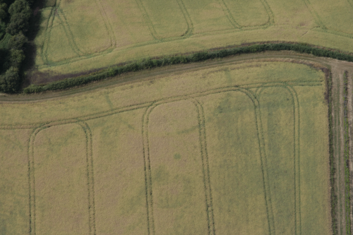 features (ring-ditches) that may represent important Bronze Age sites and a square cropmark enclosure that may be an Iron Age farmstead. Some areas of the parish like the orchard in the centre of the village have remained in pasture and preserve earthworks that may give clues into the medieval development of the settlement. features (ring-ditches) that may represent important Bronze Age sites and a square cropmark enclosure that may be an Iron Age farmstead. Some areas of the parish like the orchard in the centre of the village have remained in pasture and preserve earthworks that may give clues into the medieval development of the settlement.
The majority of the records relate to the changing settlement pattern of Brampton Abbotts and the loss of buildings recorded on the tithe apportionment map of 1838. Initial observations from historic mapping suggest a significant amount of change in this landscape from the beginning of the 19th century. Throughout the 19th century fields were amalgamated and settlement patterns shifted. Only a handful of buildings survive in the parish from the early 19th century.
With the support of a small number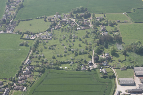 of volunteers the project will make a better record of the archaeology of the parish and through this, improve our under-standing of how the parish has changed over time. At the end of the project, a final summary document on the archaeology of the parish will be produced. of volunteers the project will make a better record of the archaeology of the parish and through this, improve our under-standing of how the parish has changed over time. At the end of the project, a final summary document on the archaeology of the parish will be produced.
From the initial assessment it is envisaged that for Brampton Abbotts the following tasks could be done:
1. To visit the sites already present on the record and to improve their descriptions.
2. To identify new sites from local knowledge, field observation and historic mapping and create records for these.
3. To identify those buildings that survive from the early 19th century (those present on the tithe apportionment map) and with the permission of their owners make a photographic and descriptive record of them.
4. To use historic mapping and documentation in the Hereford Record Office to improve our understanding of how the settlement has changed over the centuries.
* Cropmarks are the response of the growing crop to surviving archaeology below the ploughsoil. The deeper soil of a ditch will retain more moisture than the surrounding land and the crop will grow taller and ripens later. The reverse is true where walls are present and the crop is stunted in growth and ripens earlier.
This page will be developed as information about the exploration comes in. Exciting Stuff!!
The group will be making site visits on September 26th to inspect several field sites and old houses identified as being in existence on the 1838 Tithe Map.
Copies of the map can be purchased from www.geoffgwatkinmaps.co.uk
|